
简介
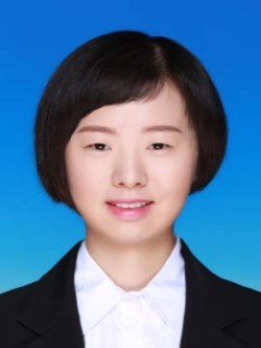
杨隆珊,女,毕业于中国地质大学(北京),博士,讲师,电子邮件:yangls@gzu.edu.cn。
招生学科方向
硕导:测绘科学与技术(摄影测量与遥感,地理信息系统与制图工程方向)、资源与环境(测绘工程方向)
主要研究领域与方向
遥感影像智能解译
教学活动
主讲课程:地图制图学基础、遥感数据处理等
在校硕士研究生情况:
2022级:袁再隆、柳小娟
2023级:胡益豪,邱莲
2024级:吴建红
近年来主要承担的科研项目
主持纵向科研项目:
[1]2024.1-2026.12国家自然科学基金青年基金:基于深度特征表示模型的稳健高光谱解混方法研究(42301440),30 万元,在研;
[2] 2023.1-2025.12,贵州省科学基金:联合空谱特征约束下非负矩阵分解方法对高光谱遥感影像的解混研究(黔科合基础-ZK[2022]一般133号),10 万元,在研;
[3] 2022.01-2024.12,贵州大学人才引进项目基于特征建模约束非负矩阵分解方法的高光谱影像解混研究(贵大人基合字(2021)67号), 5 万元,结题。
[4]污染场地变化检测技术研究,7万元,结题
近年来主要发表学术论著
[1] Yang L, Luo P, Zhang Z, et al. A spatio-temporal unmixing with heterogeneity model for the identification of remotely sensed MODIS aerosols: Exemplified by the case of Africa[J]. International Journal of Applied Earth Observation and Geoinformation, 2024, 132: 104068. (SCI, 2区期刊)
[2] Yuan Z, Yang L. Hyperspectral image clustering by superpixel-based low-rank constrained bipartite graph learning[J]. IEEE Geoscience and Remote Sensing Letters, 2024.
[3] Yang L, Peng J, Wang Y, et al. Semisupervised Hyperspectral Image Classification via Superpixel-Based Graph Regularization With Local and Nonlocal Features[J]. IEEE Journal of Selected Topics in Applied Earth Observations and Remote Sensing, 2022, 15: 6645-6658.
[4] Yang L, Xu L, Peng J, et al. Nonlocal band-weighted iterative spectral mixture model for hyperspectral imagery denoising[J]. IEEE Transactions on Geoscience and Remote Sensing, 2020, 58(8): 5588-5601.
[5] Yang L, Peng J, Su H, et al. Combined nonlocal spatial information and spatial group sparsity in NMF for hyperspectral unmixing[J]. IEEE Geoscience and Remote Sensing Letters, 2019, 17(10): 1767-1771.


 贵州大学矿业学院公众号